Roger W Haworth Friday, 2024-12-27, 06:14:32

Welcome Guest
RSS

Main Page | Roger's blog | Register | Log in

Site menu
Calendar
«  March 2008  »
SuMoTuWeThFrSa
      1
2345678
9101112131415
16171819202122
23242526272829
3031
Search
News calendar
«  March 2008  »
SuMoTuWeThFrSa
      1
2345678
9101112131415
16171819202122
23242526272829
3031
Search
Statistics
Main » 2008 » March » 27
Despite the fact that the airport at Manston in Kent is 124 km (77 miles) from London, it insisted on calling itself London Manston Airport as can be seen on this "2½ inch" OS map (1:25,000 on paper or 625 pixels/km in the full size version) from 2005.


It now calls itself by the more realistic title of Kent International Airport. Same map in 2008:
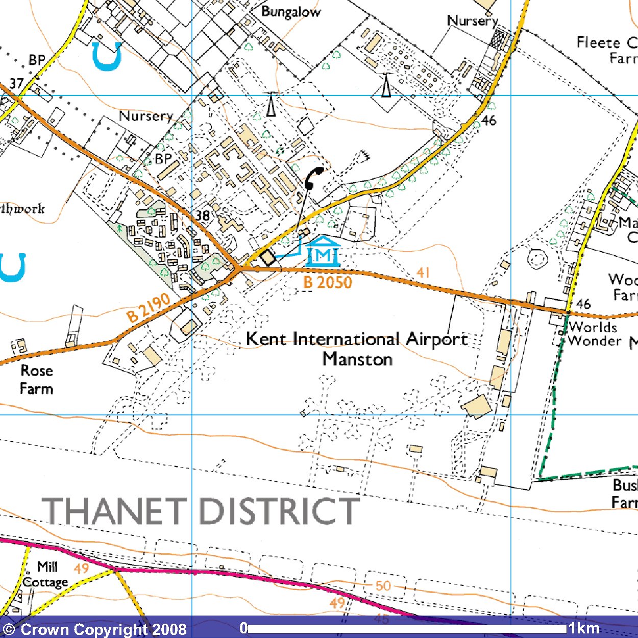
The current state of the map can be seen here.

Images produced from the Ordnance Survey Get-a-map service and reproduced with kind permission of Ordnance Survey.
Views: 7811 | Added by: RHaworth | Date: 2008-03-27

Host's advert

Copyright Roger W Haworth © 2024      Hosted by uCoz